News Story
Featured Faculty: Kaye Brubaker
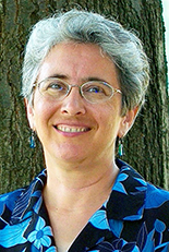
Generations of women have contributed to engineering, and Clark School women are proud to be part of that tradition. In honor of women’s history month, the Clark School is celebrating one female engineering faculty member each day. Read about today’s featured faculty member, Kaye Brubaker.
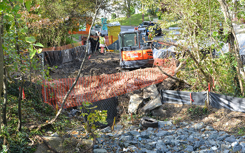
ENCE200 Takes on Campus Creek Stormwater Mapping Project with Support from a CEE Alum
Associate Professor Kaye Brubaker teamed up with CEE alumnus and Founder of Mapistry Ryan Janoch (M.S., ’08) to provide a unique opportunity for the 57 students enrolled in ENCE200, “Civil Engineering Computation” in Spring 2015.
In support of the University of Maryland (UMD) Campus Creek restoration initiative, students took part in a project called “Collaborative On-Line Mapping Using Mapistry,” through which they used Mapistry’s stormwater mapping software with location-enabled phones and tablets to map the right and left banks of Campus Creek, between where the creek flows under University Boulevard and where it enters Paint Branch.
In addition to geolocating the banks of the stream, the students’ mission was to mark locations where they observed ponds, pools, bridges, tributaries entering Campus Creek, storm drain outfalls, evidence of erosion, and more. They were also asked to photograph the stream banks and use Mapistry’s software to create hyperlinks between points on the shared map and their photos.
“The idea was to get a very detailed pre-restoration understanding of the location and state of the stream and its banks,” Brubaker said. “We also wanted to identify locations where water flow is entering Campus Creek. Such locations might not show up on official maps and drawings – features like little streams following deer paths, or erosion below storm drain outfalls.”
Ryan and Allie Janoch, Mapistry CEO and a UMD computer science alumna, generously donated Mapistry’s software to the class in hopes that students would see how sustainability projects evolve from the very beginning, the data collection stage.
“Civil engineers occasionally work on public works projects that might impact them personally, but often times they are working on projects that do not affect them,” Ryan Janoch said. “By working on a project on campus, the students get to shape something that impacts them personally. The information that the students gather will be used to shape the design and ultimately the outcome of the project, which is on their own campus.”
Additionally, the students saw firsthand why mapping is an important professional skill for civil and environmental engineers, Brubaker said.
“I like the collaborative aspect of Mapistry,” she said. “Team members can share the data they are collecting in real time, rather than having to carry their devices back to an office or lab to save, store, copy, and transmit the data. It saves time and reduces losses and errors.”
Janoch said he first decided to get involved in the technology side of civil engineering after years of battling software not suited for many of the tasks he faced as an engineer.
“Ultimately, I joined with Allie so that we could reduce the amount of paperwork in the industry and allow civil engineers to get back to doing what they love,” Janoch said. “I think I was always looking for ways to improve the parts of my job that I encountered in civil engineering, and starting Mapistry was the biggest and best way to make a significant impact on the industry,” he said.
Published March 6, 2017
Related Stories
Stories / March 1, 2018
The Clark School Celebrates Women's History Month
Stories / June 1, 2017
NSF Graduate Research Fellow to Study Fate of Microplastics in...

Stories / August 4, 2014
Baecher Contributes to NRC Report on Reducing Coastal Risk
Stories / July 14, 2014
Forman Awarded NASA New Investigator Award for Global Snow...
Stories / March 2, 2026
Celebrating Women’s History Month & Multiracial Heritage...
Stories / November 13, 2018
Snow Is More Complicated Than You Think
Stories / October 30, 2018
Prince George’s County Stormwater Collaboration Taps Recycled...
Stories / October 11, 2018
Can Cascading Pools Help Restore the Chesapeake Bay?
Stories / June 15, 2018
CEE-Led Research Featured in ES&E Magazine
Stories / May 10, 2018
CEE Student Receives 2018 Dean's Master's Research Award